AI4TWINNING
Subproject: Digital twin data consistency across multiple representations
Principle Investigator
Prof. Dr. Thomas H. Kolbe,
Chair of Geoinformatics
Project contributor
Medhini Heeramaglore, M.Tech.,
Chair of Geoinformatics
Project summary
Develop objective measures to assess the level of consistency between various 3D representation types when compared against each other to
- enable AI/ML algorithms to learn to reconstruct and segment building objects according to semantic modelling standards.
- to assess the changes over time
- to allow information flow between 3D representations across spatial and temporal scales
Project (preliminary) results
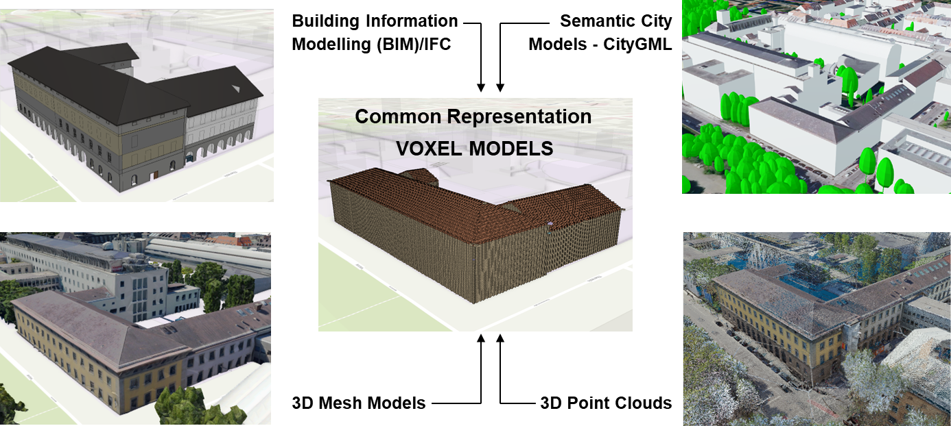
- Identifying a common representation type that can flexibly accommodate variation in geometry, semantics levels of detail and spatial extents i.e a)
-
‘Volumetric Pixels’ or ‘Voxels’ so that a match can be established.
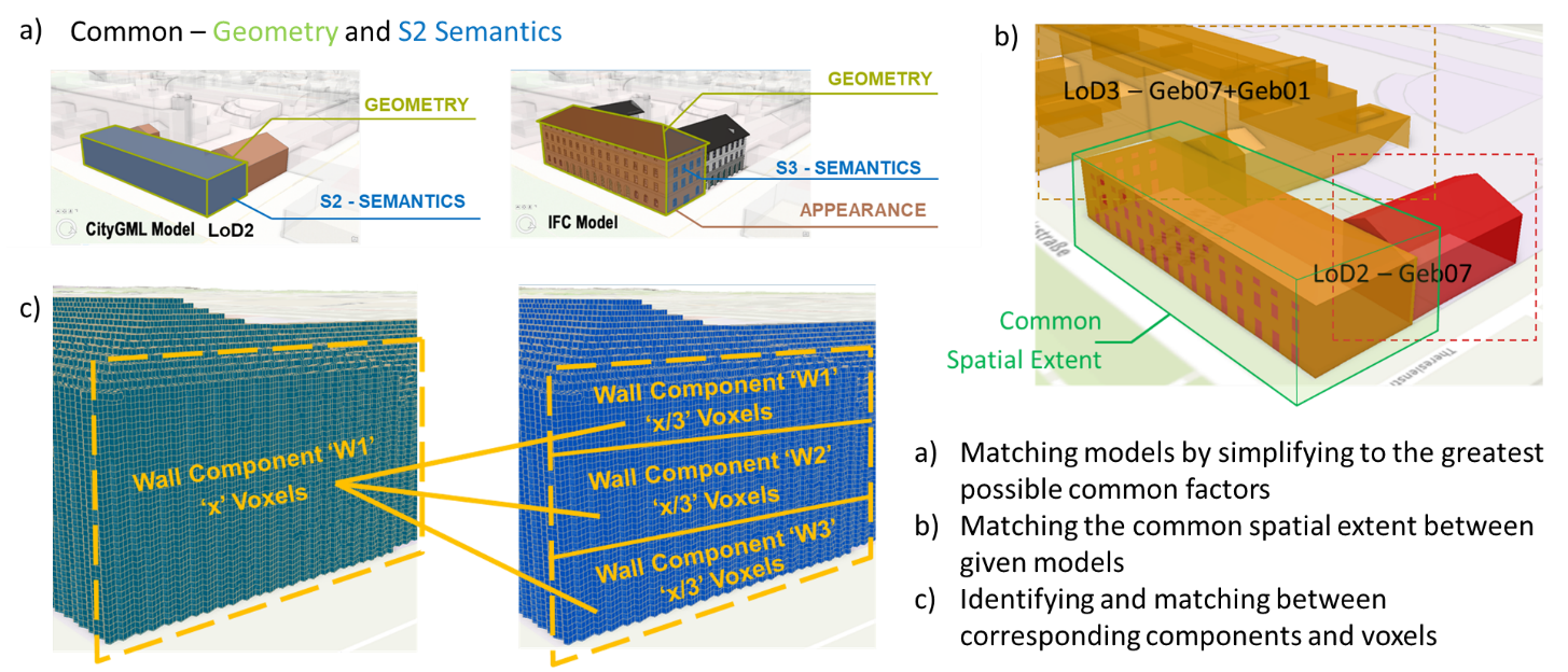
Developing an ontology for matching the various model representation in terms of
Level 1. Semantic classification level
Level 2. Spatial Extent
Level 3. Component level match
Project publications
Heeramaglore, Medhini; Kolbe, Thomas H.: Semantically Enriched Voxels as a Common Representation for Comparison and Evaluation of 3D Building Models. Proceedings of the 17th International 3D GeoInfo Conference 2022 (ISPRS Annals of the Photogrammetry, Remote Sensing and Spatial Information Sciences), 2022 [Full text DOI]